Alerts

To keep you informed of important messages from the city!

2026-08-27

LIFTING of the preventive boil water advisory issued on August 25 for all of Dragon Street addresses

LIFTING of the preventive boil water advisory issued on August 25 for all of Dragon Street addresses

2026-08-25

LIFTING of the preventive boil water advisory issued on August 20 for certain addresses on Charlevoix, Rougemont and Marcel-Meloche Streets

LIFTING of the preventive boil water advisory issued on August 20 for certain addresses on Charlevoix, Rougemont and Marcel-Meloche Streets

Works Info

Stay informed about the work being carried out in the city, whether it involves road repairs, infrastructure maintenance, work on the water network, or park redevelopment. For any questions or to report an issue related to the work, please call 514-694-4100.

2026-08-29

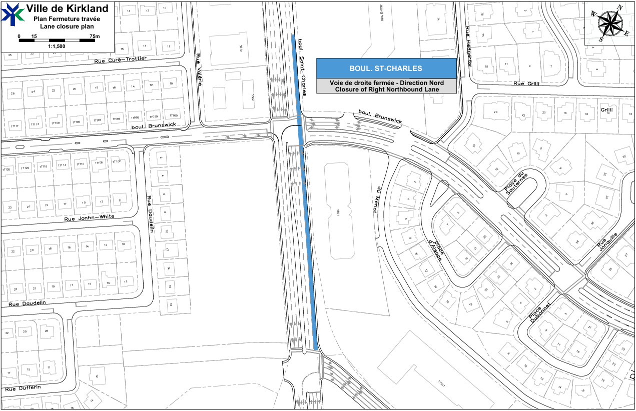
Lane closure on Saint-Charles Boulevard North on August 29 – Hydro-Québec work

Lane closure on Saint-Charles Boulevard North, from the Saint-Charles interchange to north of Brunswick Boulevard, on August 29 – Hydro-Québec work

2026-08-28

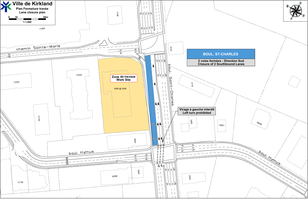
Lane Closures on Saint-Charles Boulevard South on August 28

Lane Closures on Saint-Charles Boulevard South, between Sainte-Marie Road and Hymus Boulevard, on August 28...

2026-08-07

Road Reconstruction – Place du Souvenir, Aesop St., Allard St., Derome St., Pasquini St.

Road Reconstruction – Place du Souvenir, Aesop St., Allard St., Derome St., Pasquini St.

2026-08-03

Replacement of a section of the storm sewer network on Argyle Street

Replacement of a section of the storm sewer network on Argyle Street.

2026-06-29

Reconfiguration of the merge lane onto Saint-Charles Boulevard South at the Sainte-Marie Road East intersection

Reconfiguration of the merge lane onto Saint-Charles Boulevard South at the Sainte-Marie Road East intersection, starting June 29.

Town of Kirkland

The REM in Kirkland

Planning Process of the Kirkland REM Station Site

Information Video

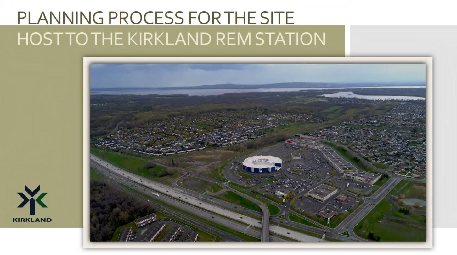
Planning process of the Kirkland REM station site

This information video presents the planning process for the site host to the Kirkland REM Station. This presentation aims to provide a summary of the work accomplished since the last consultation activities and specifically address the strategic vision developed to requalify the site. It will also touch on the consultation and planning process that will structure the vision. This initiative is in keeping with the commitment of the Kirkland Town Council to inform citizens on the progress of this major project and to continue the dialogue with the citizens.

June 2025

On the Road to Shaping the Future of the Kirkland REM Station Area

Building a Welcoming, Multigenerational Neighborhood

With the arrival of the REM and the growing demand for diversified housing options that respond to the evolving needs of our seniors and young families, the Town of Kirkland has entered a pivotal new phase in its development. The adoption of the Special Planning Program (SPP) reflects our commitment to creating an inclusive and lively residential neighborhood, designed to serve Kirkland residents of both current and future generations.

Over the next 5 to 15 years, this phased-in approach development will gradually transform the site into a welcoming residential environment, with green spaces, a central plaza, and neighborhood retail offerings. This initiative seeks not only to revitalize a heavily paved area, but also to enhance quality of life by fostering a greener and more people-oriented urban fabric.

A Controlled, Gradual, and Transparent Development Process

Development will be carried out progressively, with each phase subject to review by the Urban Planning Advisory Committee (CCU) and the Municipal Council, in accordance with the Site Planning and Architectural Integration Program (SPAIP). Existing businesses are expected to remain operational during the different phases, ensuring continuity while allowing for thoughtful integration of new components.

Dedicated Parking for Kirkland Residents

In anticipation of the upcoming REM opening currently planned for the fall of 2025, the SPP also confirms a formal agreement with the site owner to provide 200 parking spaces for Kirkland residents. Further details regarding access and operation of this parking facility will be announced in the coming months.

Next steps of the Special Planning Program (SPP)

The project has been meaningfully shaped by community input, following several public consultation activities previously held, of which:

  • a roundtable workshop to define project priorities and vision
  • a video presentation on the Town’s website
  • an online consultation period that allowed residents to ask questions and share valuable ideas

Building on these important steps, the adoption process of the Special Planning Program (SPP) for the Kirkland REM Station site began on June 9, 2025, with a public consultation to present the key elements of the SPP scheduled for July 2, 2025, at 7:00 PM at Kirkland Town Hall.

For any questions or additional information, please write to: [email protected]

To view the draft SPP bylaw, please click here: BY-LAW NO. 90-54-11 

The Kirkland Town council would like to thank all residents who actively participated in this important process. Know that you have played a crucial role in refining the project to better reflect our community’s needs and aspirations.  THANK YOU!

Frequently Asked Questions

In this section, you will find answers to the questions of public interest to the entire population, that were sent to us regarding the requalification project. All the questions we receive are grouped according to the main topics that emerge, and reformulated according to the following themes:

Q. How will the City prevent REM users from parking on neighbouring streets near the station?

A. The Town of Kirkland will not tolerate on-street parking in neighbouring areas for REM users.  Enforcement measures will be put in place to prevent this type of behavior, before the REM is put into service.


Q. Why is there no mention of the necessity for parking in the highlights of the comments made by residents at the 2017 participatory workshop?

A. This concern was not raised at the time as the initial project included a large incentive parking on the site, as well as a new road infrastructure to facilitate access to the parking area. 

When it was announced that the incentive parking initially proposed would not be built on the site, the Kirkland Town Council took it upon itself to address the need expressed by citizens, and required that the Special Planning Program for the site incorporate parking spaces designated specifically for Kirkland citizens, near the station.


Q. How many parking spots will be reserved for Kirkland citizens using the REM?

A. We are presently finalizing an extensive traffic study to ensure the proposed number of parking spaces do not cause adverse traffic conditions.  The main development orientations of the SPP currently provide for approximately 200 parking spaces reserved for Kirkland citizens using the REM.


Q. Will the STM adapt their bus routes to improve access to the REM stations servicing Kirkland residents?

A. Yes, the STM is presently reviewing their bus routes in preparation for the arrival of the REM in the West Island.  However, final plans have yet to be confirmed. 

In addition, the Town of Kirkland is currently developing its sustainable mobility plan to improve accessibility, safety, fluidity and cohabitation of the various modes of transportation on its territory, including public transit.

Q.  Where will the parking area for Kirkland citizens who want to take the REM be located?

A.  Considering that the site redevelopment project is at a very early stage, it is currently not possible to confirm the location of the future parking for the REM.

However, the SPP will include conditions requiring that parking for REM users be located on the RioCan site, within comfortable and functional walking distance of the REM station.


Q. What does it mean « to requalify »?

A. The requalification of a site can be defined as a change of vocation characterized by a change of activity aimed at redefining its role to ensure its viability.

In this case, the site covered by the SPP, whose vocation is entirely commercial, will be requalified so as to include a mix of residential and commercial uses integrating parks, green spaces and public places.


Q. Who is the author of the SPP?

A. Municipalities are responsible for the preparation, adoption and enforcement of their by-laws, including those pertaining to Urban Planning such as the Special Planning Program.  In this instance, the Town of Kirkland mandated Provencher_Roy, a prominent architectural and urban planning firm, to assist its Urban Planning Department with the preparation of the SPP.


Q. Will there be opportunities for citizen participation in the development of the SPP?  

A. As mentioned in the SPP information video, the consultation process began in 2017 with a participatory workshop attended by 280 citizens. 

The current release of this information video coupled with the invitation extended to our citizens to submit their questions, comments and suggestions, is another step of the consultation process with citizens.

The next step will be a citizen information session and public consultation on more specific details of the Special Planning Program, in the spring of 2023.


Q. The information video refers to the site to be requalified, as a “strategic area”.  Are there any other “strategic areas” within the Town’s boundaries?

A. Strategic areas within municipal boundaries are defined in a municipality’s Planning Program.  The Town of Kirkland’s Planning Program dates back several years and requires a complete overhaul, which is currently underway, and will be subject to a public consultation with citizens in the spring.  Other locations defined as “strategic areas” in the Town’s new Planning Program will be presented at this public consultation.

Q. Is the Colisée Kirkland cinema destined to disappear as part of the site’s requalification project?  What about the other buildings on the site? 

A. The decision whether to demolish an existing building, keep it in its current form, relocate it elsewhere on the site or give it a new configuration rests entirely with the owner of the site.

The SPP is a regulatory planning tool developed by the city to frame the desired vision for the redevelopment of this site, as defined by the city and its citizens.  There will be no requirements to demolish any buildings, such as the cinema, in the SPP.

Once adopted by the Kirkland Town Council, the Special Planning Program will serve as a regulatory framework compelling the site owner to comply with its requirements and redevelop the site in accordance with the vision determined by the citizens and the municipality.


Q. How many residential/commercial units are considered on the site?

A. The number of residential/commercial units has not yet been determined.  Different scenarios are currently under study.

In determining this number, several factors must be taken into account, such as the capacity of our infrastructure (road network and municipal services), the impact on traffic, the integration of the project into its environment and the economic viability of the project.

The scenario deemed optimal will be presented at the citizen information session and public consultation in the spring of 2023.


Q. Will the requalification project take place regardless of the presence on the site of an incentive parking for REM users?

A. As mentioned in the information video, once adopted by the Town Council, the SPP will serve as a regulatory framework compelling the site owner to comply with the SPP’s major development orientations, including, the requirement for any requalification project submitted to the Town, to include parking spaces reserved specifically for Kirkland citizens. 


Q. Will the pedestrian and cycling network be improved in anticipation of the arrival of the requalification project and the REM station?

A. Yes, various options are currently being explored to create new pedestrian and cycling links that can connect to existing networks near the site. In addition, the city is currently developing its sustainable mobility plan that aims to create various secured connections to the REM station and the site to be requalified.

It should also be noted that the REM station will have bicycle parking facilities for cyclists wishing to go to the site or take the REM.

In addition, as mentioned in the presentation, the Lien de l’Ouest located along the western side of the site will include secure pedestrian and bicycle connections, as well as a new cycling and walking footbridge linking the south and north sides of Highway 40 and the future Grand Parc de l'Ouest on both sides of the highway.

Q.  What is the timeline for the SPP and the project to requalify the site?
 
A.  The city hopes to finalize and adopt the SPP in 2023. Once the regulatory tools and the SPP are adopted, the site owner will be able to present a concrete project that they wish to carry out, following the guidelines and legislative framework of the SPP.

Several authorizations are required before demolition and construction can actually begin (various approvals from the Planning Advisory Committee, the Demolition Committee and the Town Council, obtaining permits, etc.).

Depending on the willingness of the site owner, such a project could realistically be realized within 5 to 10 years.

Q. What are the planned car accesses for new residents on the site, visitors to the new businesses and the new public plaza, as well as for REM users? 

A. The preliminary grid of proposed streets on the site is shown in the “Spatial Organization Concept” section of the SPP information video.  Essentially, the new development will use the same access and egress points currently found at the RioCan Commercial Centre, with the difference that they will be public roadways instead of private access roads.

Given the current status of the SPP, it is too early to identify all of the road connections on the site.  Further details will however be provided at the citizen information session and public consultation in the spring.

Q. What is the estimated impact of the project on traffic, roads and the environment?  Will mitigation measures be required?

A. With regard to the estimated impact of the project on traffic and the road network, a traffic study considering different scenarios, is currently under analysis. This study aims to confirm the capacity of the existing road network to accommodate the project without affecting the quality of life of residents in the surrounding areas and without causing adverse traffic conditions. Upcoming reports will allow the Town to properly identify the issues at hand and define potential solutions.

For information purposes, mitigation measures can be implemented as part of a traffic study, if required.  The findings of the traffic study will be presented at the citizen information session and public consultation this coming spring.

As concerns the environment, in order to ensure the harmonious integration of the project into neighboring areas, the planning of the SPP includes several sidewalks and cycling paths to promote active transportation and the use of the REM.  In addition, an abundance of green spaces and the planting of a multitude of trees will transform the site, one of the West Island’s largest heat island, into an oasis of greenery.

Q.  Why does the new « Lien de l’Ouest », better known as the A-440 right-of-way, not permit vehicular traffic?

A.  The “Lien de l’Ouest” is a large green space that forms an integral part of the “Grand parc de l’Ouest”.  It is destined to provide recreational activities and user-friendly links to this future major regional park. For information on the “Grand parc de l’Ouest”, click here.

The development of the “Lien de l’Ouest” into a corridor for pedestrians, cyclists and buses is the result of an agreement between the Ministry of Transport and Sustainable Mobility and the agglomeration of Montreal. This agreement was ratified in 2018 and does not include the presence of motor vehicles.

The Town of Kirkland ensures that every effort is made to create local connections between its local active transportation network (pedestrian and bicycle) and the “Lien de l’Ouest”.

Q.  Will Jean-Yves Street reopen soon and will it remain open during the construction of the site’s redevelopment project?

A.  On account of the ongoing work that CDPQi is conducting at the Kirkland REM station, it is unfortunately not possible to confirm the date at which Jean-Yves Street might be reopening.

During the construction period, the Town of Kirkland will take the necessary measures to ensure that all vehicular accesses, including Jean-Yves Street, remain open, safe and fluid.